Rose Valley Lake Loop in West Kelowna, BC
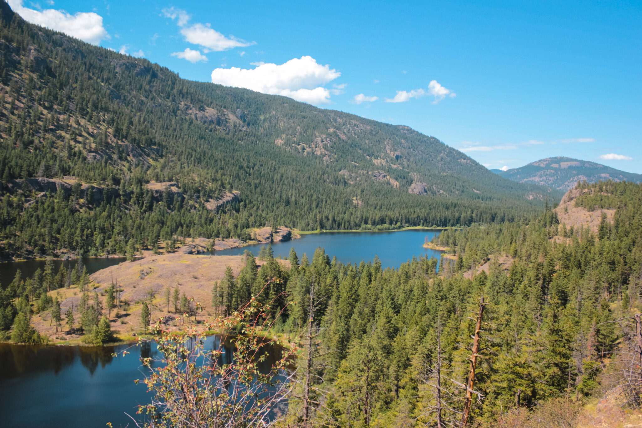
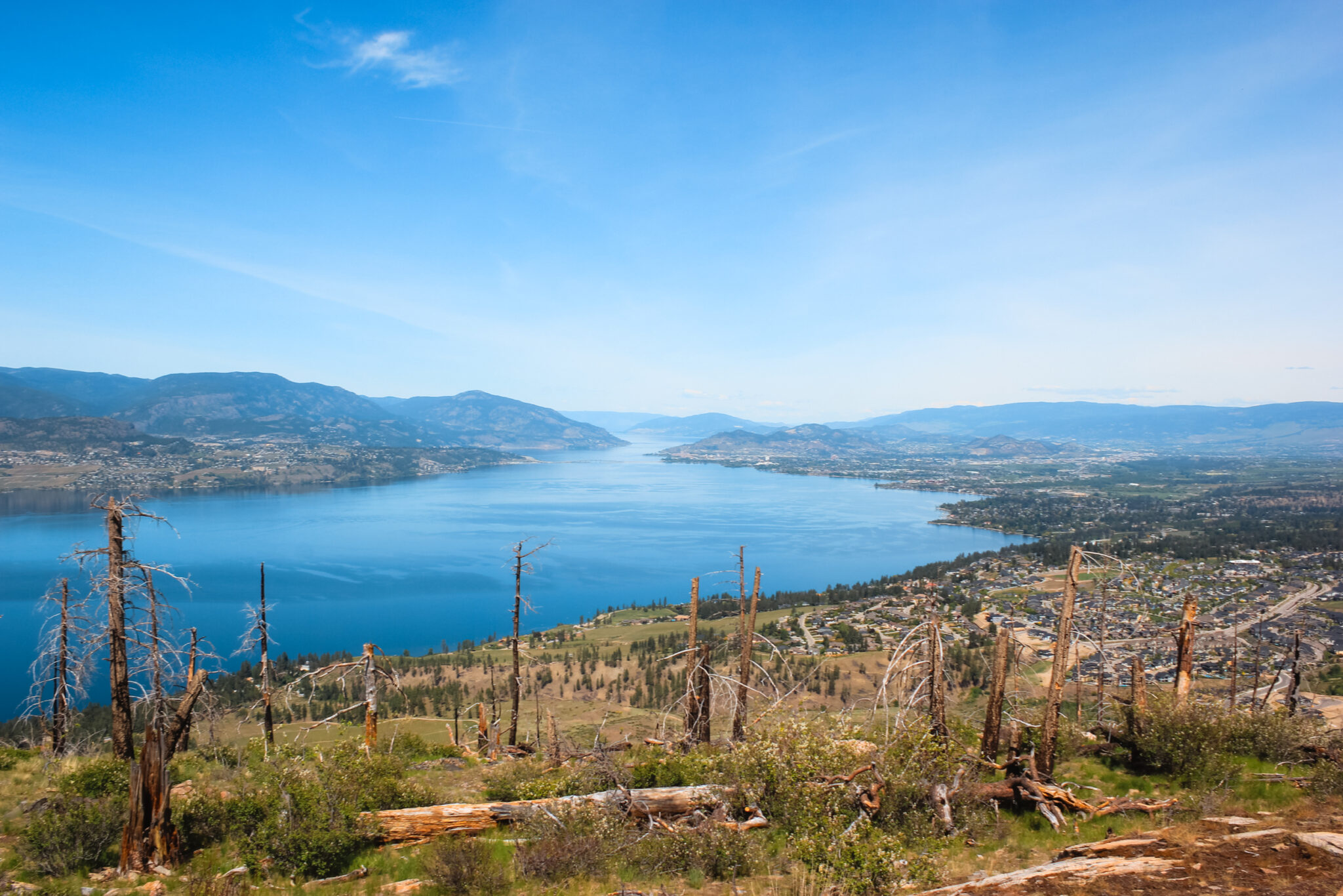
The Rose Valley Lake Loop in West Kelowna traces the shores of the rocky, tree-lined Rose Valley reservoir and rises high into the hills for panoramic views.
The Rose Valley Lake Loop hike is an unofficial trail near Rose Valley Regional Park in West Kelowna. Despite sharing a name with the regional park, the hike is mainly on Crown land and only briefly enters the park.
You’ll experience all kinds of terrain on this hike: shaded forests, sun-drenched volcanic plateaus, steep hills, and lush lakeshores.
Although it traces a lake’s shoreline, at some points the Rose Valley Lake Loop rises to the same heights as the official trails in Rose Valley Regional Park. You’re in for quite a workout! Between the varied terrain and constant up-and-down of the trail, this isn’t a lazy-day hike.
Rose Valley Lake Loop Map
The Rose Valley Lake Loop isn’t an official trail, so you’ll find many different versions online. Below you’ll find my recommended loop around the Rose Valley reservoir — this hiking route keeps as close to the lake as possible and also detours to the dam at the south end of the lake.
There are a lot of trails in the Rose Valley network — for clarity, I haven’t included these trails in the map below. Many of these trails branch off from my recommended route and you can definitely take these other trails to change up your hike.
- Difficulty: Moderate
- Trail Type: Loop & network
- Trailheads: Rosewood Dr, Roseridge Ct, Rose Valley Parking, West Kelowna Rd, Pettman Rd
- Length: ~13.9 km (map)
Trailheads for the Rose Valley Lake Loop
There are numerous trailheads for the Rose Valley Lake Loop hike. Most of these are in residential areas, so please respect the residents and only park if there’s room. If it’s full, move on to the next trailhead (they’re all close to each other).
None of the trailheads are adjacent to the loop trail, so you will need to hike in a little bit first.
- Rosewood Drive Trailhead
- Roseridge Court Trailhead
- Rose Valley Parking Lot Trailhead
- West Kelowna Road Trailhead
- Pettman Road Trailhead
Hiking Safety at Rose Valley Regional Park
Every time you head into the outdoors, it’s important to be prepared. And because the Rose Valley Lake Loop is a decently long day-hike, it’s extra important you plan ahead.
Regardless of the season you visit, you should carry the ten essentials, use a GPS or phone app, and tell someone where you’re going and when to expect you back. At the very least, these things will drastically improve your safety on the trail.
Since Rose Valley is located in the mountains, there is a possibility of encountering larger wildlife such as bears.
To keep yourself and the wildlife safe, I highly recommend RecSafe with Wildlife’s bear safety online course. Kim’s doing amazing work educating people about bear and wildlife safety!
Summer Safety
In the summer, Rose Valley gets very hot which means hydration and sun safety is at a premium. Here are some tips:
- Learn how to stay hydrated when it’s hot out
- Bring a water filter such as a Lifestraw, Steripen, or tablets in case you run out of water
- Wear UV-blocking clothing and a hat
- Wear plenty of sunscreen
- Don’t overextend yourself
Winter Safety
In the winter, Rose Valley gets icy and snowy. Here are some tips to make the most of your winter adventure:
- Snowshoes, spikes, and hiking poles make hiking a lot easier
- Brush up on your winter hiking tips
- Choose a warm jacket
- Wear sunglasses if it’s sunny
What to Expect on the Rose Valley Reservoir Hike
The Rose Valley Lake Loop, for the most part, is an easy hike that meanders around the shoreline of the Rose Valley reservoir.
However, the south end of the loop changes pretty drastically. There are plenty of steep, difficult sections as you explore the surrounding mountains. It feels like an entirely different hike!
Numerous trails connect to form the Rose Valley Lake Loop. You’ll see plenty of unmarked trails branching off as you hike, so take care to not accidentally take a wrong turn. I can’t stress the importance of using a GPS or phone app enough. Download AllTrails and use it to navigate.
And finally, all of the trails in Rose Valley are multi-use, which means hikers and bikers both use them. Keep your wits about you and practice trail etiquette so everyone can enjoy the trail.
North End & Lakeside
Regardless of which trailhead you start at, once you’re at water level on the north end of the reservoir, it’s a pretty chill hike! There’s not a lot of elevation change and you’ll basically just walk around the lake.
Some sections are forested, while others are quite exposed. There aren’t huge beaches, but there are plenty of places you could bring a chair and hang out by the water.
While here, be careful not to contaminate the water. The Rose Valley reservoir is the main source of drinking water for over 12,000 locals.
Although the entire loop is rated as moderate, this section is fairly easy. The trails connecting the trailheads to the loop are a little more difficult, but not unmanageable. If you want to keep your adventure fairly easy, use the Pettman Road trailhead.
South End & Mountainside
The most difficult section of the Rose Valley Lake Loop is, by and far, the south end.
Here, the lakeshore turns into steep cliffs and you’ll steadily climb uphill as you leave the water behind. You’ll hike through forests of ponderosa pine and over volcanic rock, all the while getting a better view of the lake.
The trail goes pretty far past the end of the lake before heading downhill to a service road. If you don’t want to hike back up the mountain to complete the loop, follow this service road south until you reach a subdivision. Or, take it north to the reservoir’s dam.
The southeast side of the loop has the most elevation gain of the entire hike.
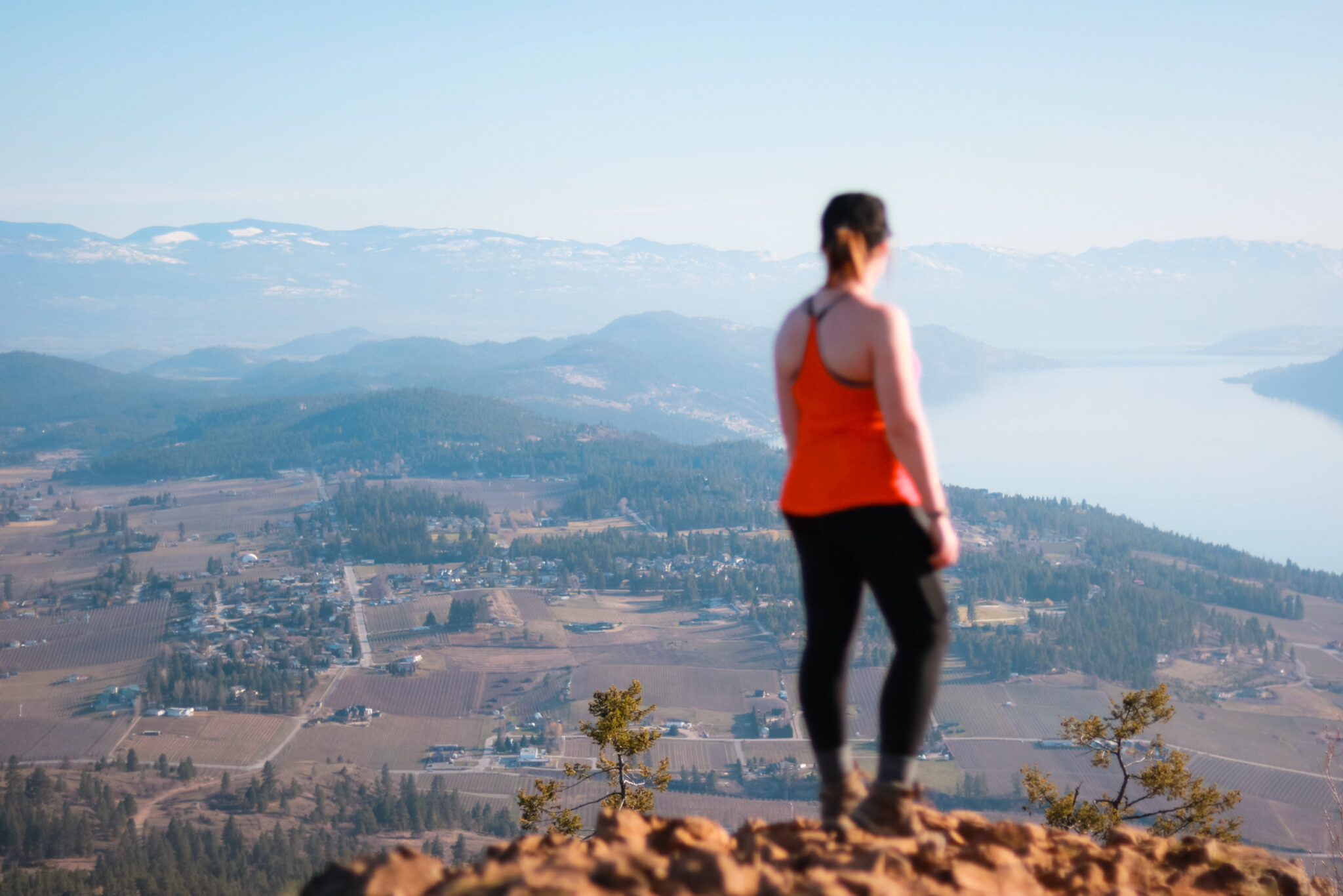
Starting from the service road, the trail heads all the way up to the top of the mountain and connects with the summit of the Bitterroot Trail, an official trail in the regional park. The views of Okanagan Lake and the reservoir are spectacular!
Rose Valley Reservoir Dam
The reservoir’s dam, located on the south end of the lake, is nothing fancy. You can walk across it and gaze all the way down the lake, though! There’s also a small road that leads to water level.
To reach the dam, follow the service road (McDougall Road) north until it ends at the dam. The service road (gated) starts at Rosewood Drive; you can start there or detour from the Rose Valley Lake Loop.
Things to Do at Rose Valley Regional Park (Other than Hike)
Believe it or not, there’s actually more to do here than hike! Rose Valley, as a whole, is a great place to soak in some much-needed nature and explore.
Mountain Biking at Rose Valley
Mountain biking in Rose Valley is probably more popular than hiking. Most of the unofficial trails around the park and Crown land have been made by mountain bikers looking for adventure.
The trails west of the Rose Valley reservoir are reportedly the mountain biking communities’ favourites — they’re rugged with plenty of cool rock formations to check out (the Edge of Forever Arch and Jabber Rock).
Recently, RDCO has been working with the West Kelowna Trail Crew Society to stop new unsanctioned trail construction, as well as name existing trails and coordinate trail stewardship.
Fishing at Rose Valley
The Rose Valley reservoir is a great place to fish! You can ice fish, teach the kiddos how to fish, or try to catch some dinner. Or simply get out there to enjoy the beautiful lake!
The Rose Valley Lake has been stocked with rainbow trout, including Pennask, Blackwater, Beaver, Tunkwa, and Knouff strains and Prickly Sculpin since the ’60s. You can enjoy fly fishing, trolling, spin casting, or ice fishing on the reservoir.
Lake access is walk-in only. You can hike in from any of the trailheads, but the easiest access is along the McDougall service road; it’s mostly flat and only takes 10 to 15 minutes to hike in.
If you want to take a boat out, you’ll need to carry in a belly boat from the trailhead. Take care to not contaminate the water because the reservoir supplies drinking water for thousands of people.
Swimming in the Rose Valley Reservoir
I haven’t found information on any official sites about whether or not you’re allowed to swim in the Rose Valley reservoir. However, blogs and forums say it’s a lot of fun to swim here, especially on a hot summer day.
Because of the lack of official information, I don’t feel comfortable advising you one way or the other. The lake itself is quite calm, but I worry most about contamination. However, I do believe in sharing information.
If you do choose to swim in the reservoir, the best swimming is found at the north end of the lake, away from the dam and the steep cliffs. There are a few small “beaches” you can use as a base. And as I’ve said before, take lots of care to not contaminate the water.
Kayak, SUP & Canoeing on Rose Valley Reservoir
As with swimming, I couldn’t find official information about paddle sports on the reservoir. Having said that, fishing websites talked about using inflatable boats, so it stands to reason you could also carry in a kayak, SUP, or canoe.
There are no boat launches, so you’ll need to carry in your gear from a trailhead.
The easiest way to access the reservoir is to park at the Rosewood Drive trailhead and follow the McDougall service road to the dam. At the dam, there’s a small path that leads to the water.
Bird Watching in Rose Valley Regional Park
Bird watching is great at Rose Valley — there’s lots of space and few people. Hang out by the water, head into the forest, and look for some feathered friends.
According to eBird, an online birdwatching website, approximately 185 birds have been seen in Rose Valley Regional Park, including different species of eagles, hawks, woodpeckers, owls, songbirds, and other cool birds!
If you love bird watching, I highly recommend following Kalin Ocaña (@birdz.okanagan) on Instagram. He takes beautiful photos of birds in the Okanagan (and occasionally elsewhere).
Skating on Rose Valley Reservoir
In the winter, the Rose Valley reservoir usually freezes over and can be a really fun place to go skating.
Before you skate on the lake, though, check that it’s safe. Falling into a frozen lake can be life-threatening, so please take plenty of precautions and have a safety plan in place.
Ice should be a minimum of 20+ cm thick, plus a clear blue colour (the strongest and deepest). Avoid white or snow-covered ice and never stand on grey ice (indicates water near the surface). Also, the ice is weakest in the center and the shoreline.
Rose Valley Regional Park FAQs
Official websites don’t say anything about swimming in the Rose Valley reservoir one way or the other. Local blogs and forums say it’s a great place to swim.
The loop hike around Rose Valley Lake is roughly 13.9 km. However, there are a lot of alternative trails that could change the duration of your hike.
Yes, you can fish in the Rose Valley reservoir. The lake has been stocked with trout since the ’60s and is a great place to fish.
There are no facilities along the trail, but you may find a few benches once you enter Rose Valley Regional Park. Also, the Rose Valley Parking Lot trailhead has an outhouse and garbage bins
