Kay Falls: A Hidden Waterfall Just Off the Trans-Canada Highway
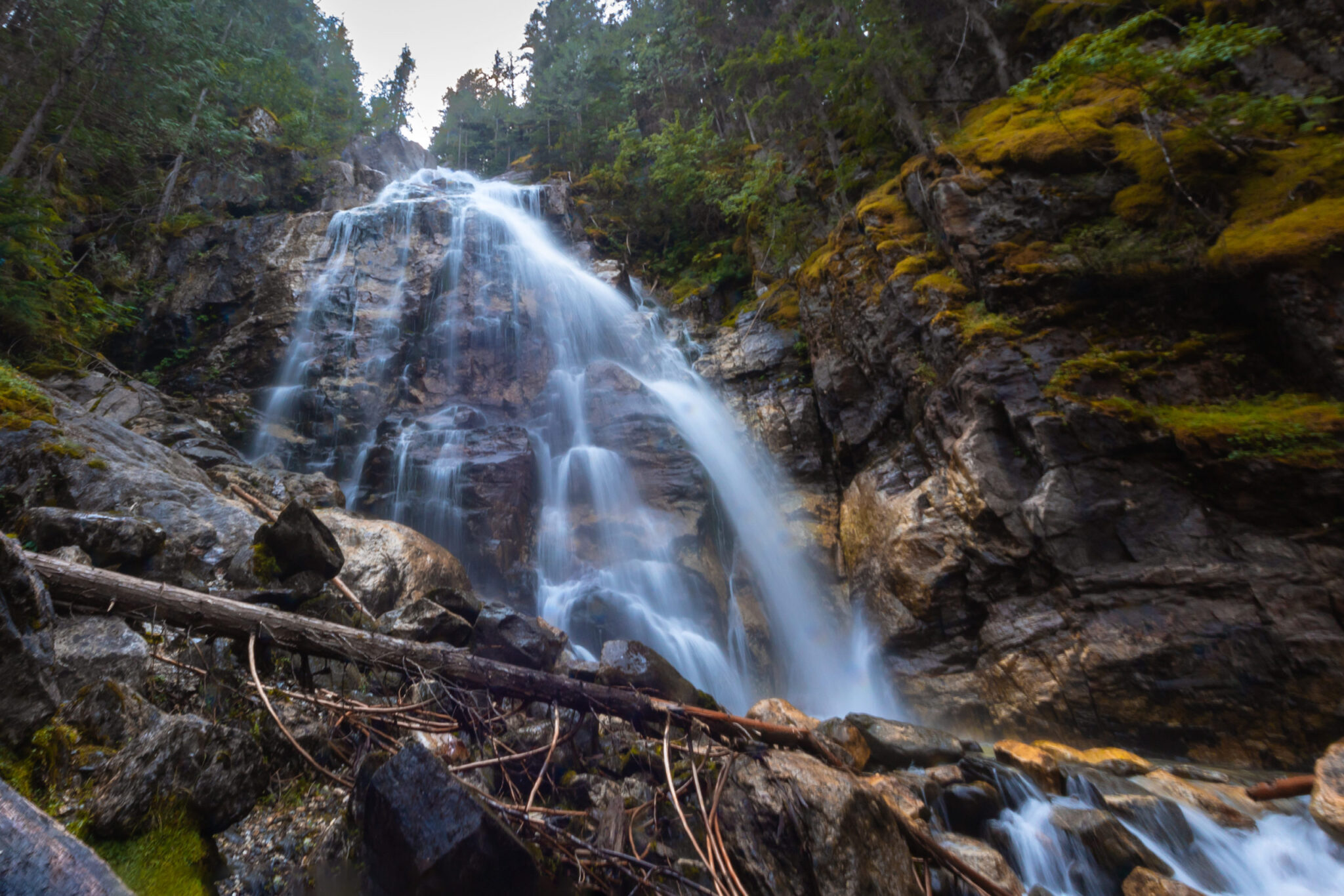
If you’re road-tripping through the BC Rockies, there’s a secret spot you’ll want to pull over for! Kay Falls is a towering 187-foot waterfall tucked between Sicamous and Revelstoke, so close to the highway you can almost see it from your car. Trust me, it’s worth the stop!
There’s no signage, no big crowds, and no long hike. Just a quick five-minute trail through the trees that leads straight to the base of a powerful, misty waterfall. It’s an easy detour with a huuuuge reward and it’s beautiful year-round!
PS: If you want to explore more local waterfalls, check out this guide to the Okanagan’s waterfalls.
Kay Falls Trail Stats
This is a short, quick trail with a big payoff. The path is narrow, slightly rocky, and can be slick in wet or icy conditions—but it’s totally doable for most hikers, even little ones.
- Distance: 150 m (one-way)
- Time: 5 minutes
- Trail Type: Out-and-back
- Elevation Gain: 29 m
- Difficulty: Easy
- Season: Year-round (winter is much more difficult)
- Fee: Free
- Trailhead: Pullout beside the Eagle River Bridge on Highway 1
- Location: Between Sicamous and Revelstoke, BC
How to Get to Kay Falls
Kay Falls is tucked just off Highway 1 between Sicamous and Revelstoke in British Columbia. It’s about 36 km from either town which makes it a perfect pit stop when you’re road tripping through the Rockies.
There’s no official signage for the trail, so it’s easy to miss if you’re not watching for it. Here’s what to look for:
- Coming from Sicamous: Drive east on Highway 1 past Crazy Creek Resort. Kay Falls is about 3.5 km further, on your right immediately after crossing the Eagle River Bridge.
- Coming from Revelstoke: Drive west past the Enchanted Forest and look for the falls about 3 km later. The pullout will be on your left—but it’s safer to approach from the eastbound lane if you can.
Set Google Maps to Kay Falls or use these coordinates: 50.97517574, -118.6062034
What to Expect on the Trail
The trail to Kay Falls is short and easy, only about 150 meters from the side of the Trans-Canada Highway. It takes maybe five minutes, but it feels like you’ve wandered way off the beaten path!
We stop here every time we’re in the area! It’s become one of those little rituals that always makes the drive way better.
Once you park at the pullout beside the Eagle River Bridge, look for the narrow path leading into the trees. There’s no sign, but it’s pretty easy to spot if you’re watching for it.
The path is a bit rocky and rooty, but it’s easy to follow. You don’t need hiking boots, but sturdy shoes help, especially in spring when everything’s wet and a little mucky.
A Waterfall That Hits You (Literally)
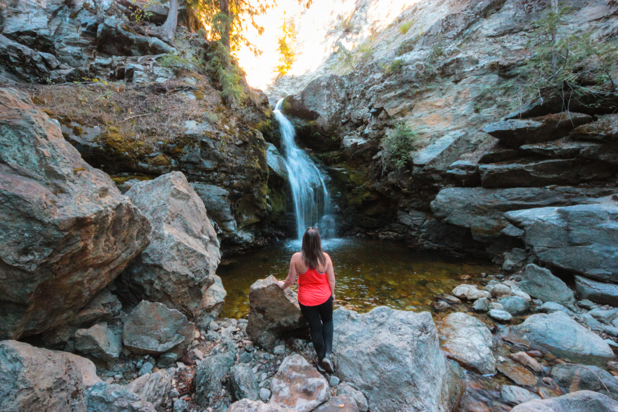
Once you’re in the trees, the traffic noise disappears and the sound of rushing water takes over. It doesn’t take long before the falls come into view, and when they do, they’re loud, beautiful, and very misty!
The waterfall is about 187 feet tall and drops straight down a rock face just a few steps off the trail. You can hang back at an unoffical viewpoint or edge a little closer if it feels safe. The rocks are slippery, so take your time and don’t push your luck.
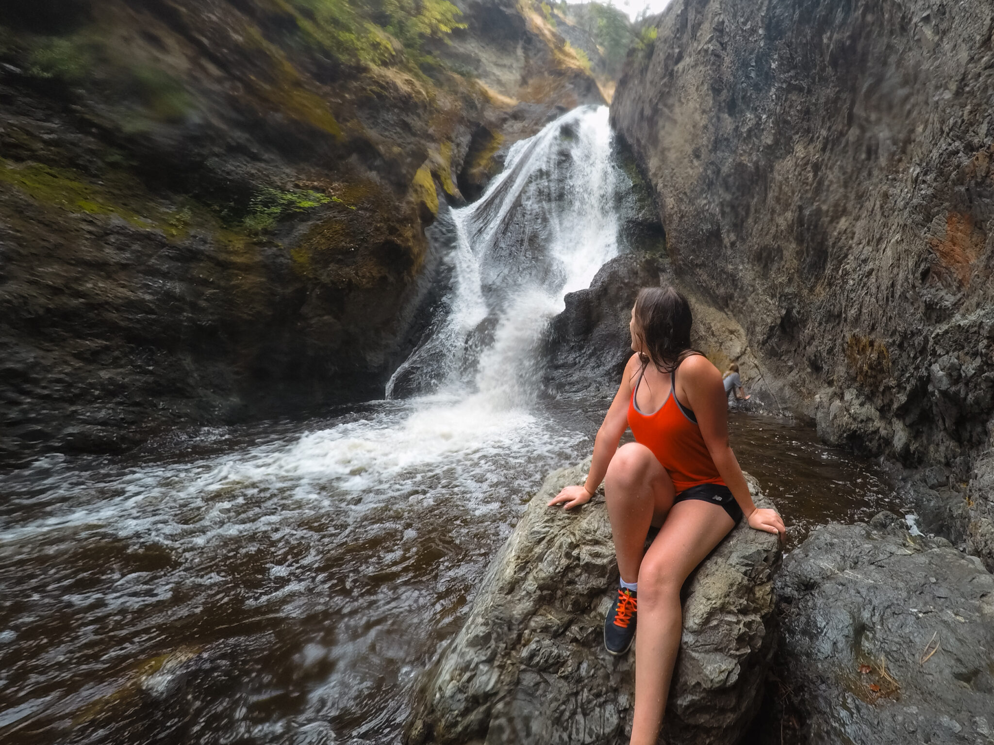
If you’re visiting during spring runoff, heads up, the mist is intense! You’ll be soaked in seconds and the spray can feel like a cold slap to the face. It’s strong enough that sometimes it’s a little hard to breathe when you get close, so bring a rain jacket and maybe some Vessis!
When to Visit Kay Falls
One of the best things about Kay Falls is that it’s open year-round and every season gives it a whole new vibe.
In spring, the waterfall is intense. The snowmelt from the Monashee Mountains sends a ton of water over the edge and the mist is wild. If you get too close, expect to get drenched, like, instant face wash. The trail can be muddy, but it’s worth it if you want to see the falls at full force.
Summer is a great time to see Kay Falls if you’re on a road trip through the Rockies. The trail is dry, the walk is easy, and the forest offers a nice bit of shade. The waterfall isn’t quite as intense as it is in spring, but it’s still flowing strong and the mist feels amazing on a hot day!
Fall is a quieter time to visit. The water slows down, the forest smells earthy, and the leaves start turning golden. It’s not as dramatic as spring, but it’s still a beautiful spot to stretch your legs and enjoy the mountains. The mist is lighter, too, so you can hang out by the falls without getting soaked.
Winter can be tricky, but it’s also really cool, literally. Kay Falls often freeze into thick columns of ice and the whole area feels extra quiet under the snow. The trail’s still short, but depending on the snowpack, getting to it can be a bit of a mission. The pullout isn’t always plowed and the trail can be icy, so you’ll want good boots and maybe microspikes.
Safety Tips for Visiting
The Kay Falls trail may be short, but it’s still a natural, undeveloped area and it can get a little sketchy if you’re not paying attention.
There are no fences, no railings, and no warning signs. The rocks near the base of the waterfall are often wet and super slippery, especially in spring or after a rain. Take your time, wear decent shoes, and don’t try to get closer than feels safe. The water’s powerful and moves fast.
In winter, ice can build up on the trail and the snowpack along the highway can be deep. If it looks unsafe or unplowed, it’s best to skip it and try again another time.
Also worth noting, this is a pull-off on a fast-moving highway. Park well off the shoulder and keep an eye out for traffic when getting in and out of your vehicle.
And finally, please follow Leave No Trace principles. There are no garbage bins here, so pack out everything you bring in. If you see litter, be a good steward and pick it up. Let’s keep this hidden gem beautiful for everyone who stops by!
Kay Falls FAQs
Not really. There’s no official parking lot, no bathrooms, and no signage. Very occasionally there’s an outhouse near the pullout, but don’t count on it. This is a quick stop, not a full rest area—plan accordingly.
This depends on what you want to see! It’s fantastic in every season, but it does change throughout the year.
In the spring when run-off is strongest, you’ll get some crazy, rushing water and it’ll put on quite the show. In the fall, you can enjoy a gently cascading waterfall. In the winter, Kay Fall freezes into a beautiful column.
Yep! The trail is short and flat enough for most pups and there’s usually lots for them to sniff. Just keep your dog on a leash, there are no fences near the waterfall and the rocks can be slippery and the water is fast.
Nope! The water is fast, cold, and rough. This isn’t a swimming kind of waterfall. You can get close enough to enjoy the mist, but you don’t want to end up in the water here.
Unfortunately, no. The path is narrow and uneven, with roots, rocks, and some mild elevation. It’s short, but not smooth.
Absolutely! If you’re already driving between Revelstoke and Sicamous, it’s a super easy detour that takes less than 20 minutes round-trip. The falls are stunning, the trail is fun, and it leaves a big impression!
Other Stops Near Kay Falls
Here are a few other quick stops between Revelstoke and Sicamous if you’re looking to stretch your legs:
- Crazy Creek Hot Pools & Suspension Bridge: Just 3.5 km east of Kay Falls. Soak in the hot pools, walk across the suspension bridge, or wander the boardwalk. It’s a fun, low-effort stop—great if you’re travelling with kids or just want to warm up.
- The Enchanted Forest: About 3 km west of Kay Falls. This quirky roadside attraction has fairytale statues, treehouses, and oversized mushrooms hidden in the woods. Super whimsical and fun if you’re into oddball stops!
- Last Spike at Craigellachie: A little farther west toward Sicamous, this historic site marks where the final spike of the Canadian Pacific Railway was driven in 1885. There’s a big parking lot, bathrooms, and a small gift shop.
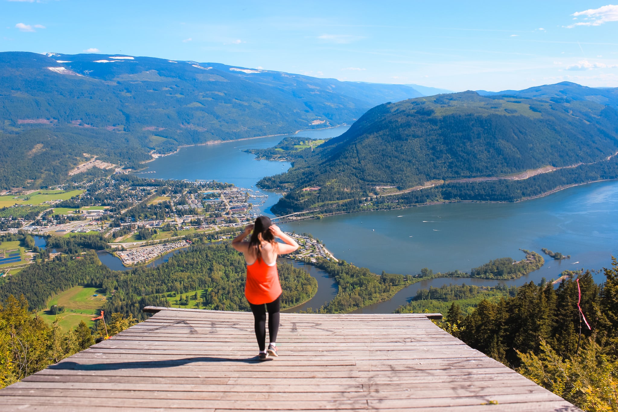
- Sicamous Lookout: If you’re up for a bit more adventure, the Sicamous Lookout has one of the best panoramic views in the Shuswap. It’s a popular hang gliding launch site and a great spot for photos. The gravel road up can be a little rough, but the view is worth it.
Final Thoughts on Kay Falls
Kay Falls might be easy to miss from the highway, but once you know it’s there, it you’ll want to revisit again and again. It’s quick, free, and surprisingly dramatic for a trail that takes less than five minutes.
Whether you’re just passing through or planning a full road trip through the BC Rockies, I highly recommend adding Kay Falls to your list. You won’t regret it and hey, if you do stop by, tag me in your pics. I’d love to see them!
