Cosens Bay Waterfall in Kalamalka Lake Provincial Park, BC
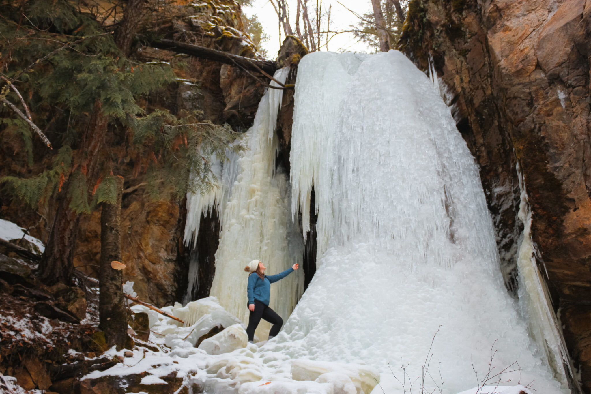
Cosens Creek Falls, also known as Cosens Bay Waterfall and Cosens Falls, is a small waterfall tucked on the south side of Kalamalka Lake Provincial Park near Vernon, BC.
Even though it’s not the biggest or most spectacular waterfall the Okanagan has to offer, this small, relatively unknown waterfall is worth a visit, especially if you’re already exploring Kalamalka Park, the beautiful provincial park it resides in.
Over the last few years, Cosens Bay Waterfall has become more well known, but it still retains a lot of its anonymity. Every time we’ve visited, we’ve had the waterfall to ourselves.
The best time of year to visit Cosens Falls is the winter and spring. In the summer, the water dries up and the waterfall virtually disappears.
Cosens Waterfall Trail Stats
There are numerous trails in Kal Lake Provincial Park that will lead to Cosens Bay Falls. These stats are based on the most direct route. There are many possible alternative (and longer) routes.
- Difficulty: Moderate
- Trail Type: Network
- Trailheads: Cougar Canyon, Kalamalka, Cosens Bay
- Length: Cougar Canyon 3.6 km (map), Kalamalka 6 km (map), Cosens Bay 6.7 km (map)
Trail Details for Cosens Bay Waterfall
Cosens Bay Waterfall is the only waterfall in Kalamalka Lake Provincial Park. The 3,218 hectares park is stunning and features amazing views, hiking and biking trails, and access to Kal Lake, the park’s namesake.
After you’ve checked out the waterfall, I highly recommend exploring more of the park.
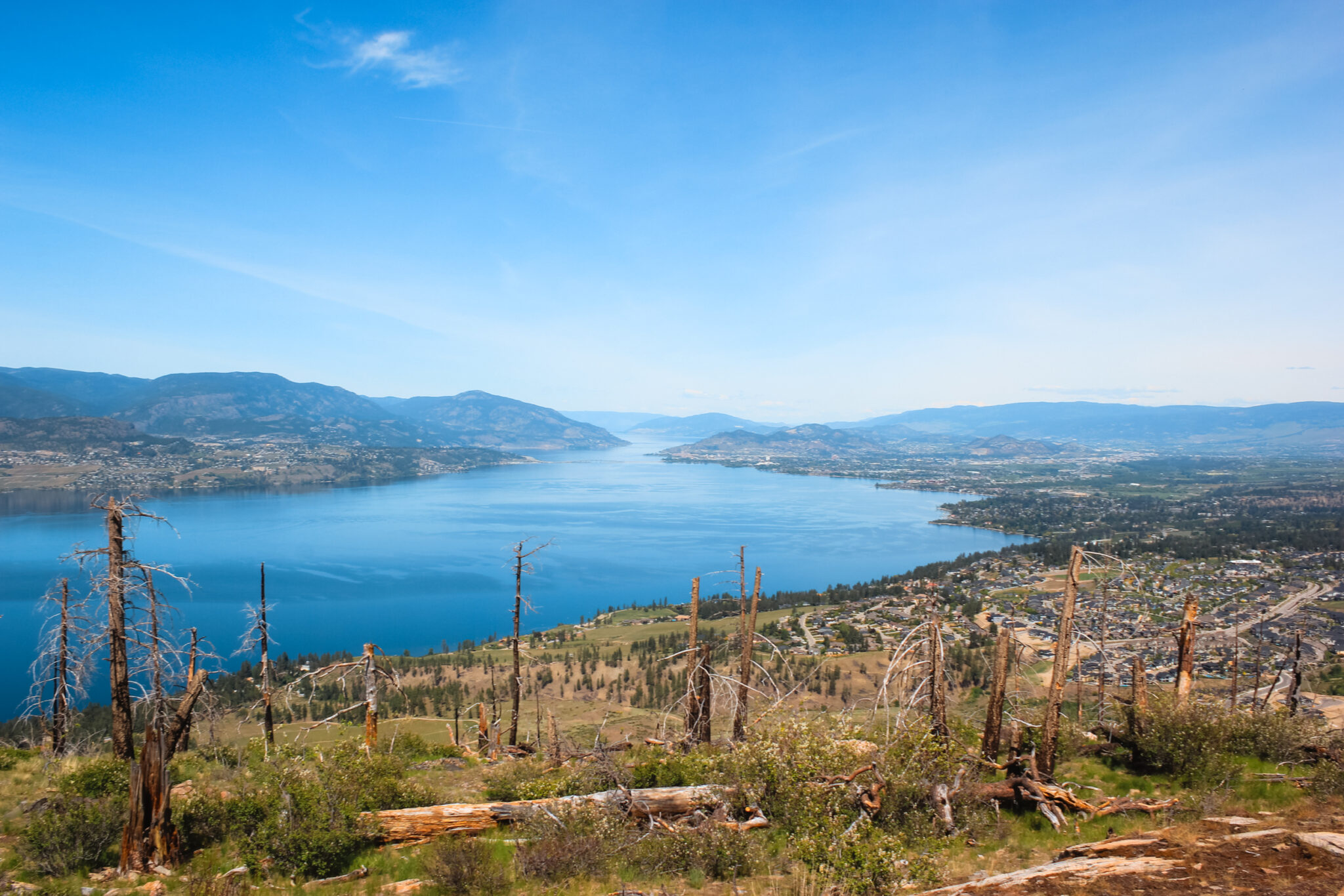
There are many ways to reach Cosens Creek Falls and no matter which trail you take, you can enjoy picturesque views of Kal Lake – especially in the summer when the water turns a vibrant turquoise!
Cosens Creek Waterfall Map
Cosens Bay Waterfall is located about halfway through the Cosens Bay Express trail at the south end of Kalamalka Lake Provincial Park.
The trail network at Kal Park is extensive, so for clarity I’ve only highlighted the most direct routes from each trailhead in the map below. Feel free to create your own route to mix things up!
Trailheads
There are three trailheads for the Cosens Bay Falls hike, all within the provincial park.
Cougar Canyon Trailhead
The Cougar Canyon trailhead is the closest to Cosens Bay Waterfall – only 3.6 kilometers round-trip hike. To reach this trailhead, drive to the Cosens Bay parking lot and continue along the dirt road that heads into the park.
Drive slow, the road is narrow, windy, and full of potholes. Stay on this road for 4.2 km until you reach the parking lot (there are signs for it). You don’t need 4WD for this road, but it’s best if your vehicle has high-ish clearance.
You’ll pass by the trailhead to the Cosens Bay Express trail, which is the trail the waterfall is located on. However, “no parking” signs have been installed along the road that prevent you from parking at the trailhead. You’ll have to hike back on the main road for a little while.
Kalamalka Parking Lot Trailhead
Located on the tip of the park near Rattlesnake Point, this is the main parking lot for Kalamalka Lake Provincial Park. The entire road into the parking lot is paved; however, the parking lot itself is not.
There are a few paths from this trailhead. At the north end of the parking lot, there’s a paved trail and info hut – don’t take that trail (technically, you can reach the Cosens Bay waterfall going this way, but it’s very roundabout).
Instead, go to the south end where two gravel trails head upwards. Take the left trail and hike for approximately 3 km (6 km round-trip) to reach Cosens Creek Falls. Take a GPS or phone app so you don’t get lost.
Cosens Bay Trailhead
The Cosens Bay trailhead is located at the parking lot on the eastern side of the provincial park. The road to the parking lot is paved, but the parking lot itself is not.
This trailhead offers easy access to the huge network of trails that run through Kalamalka Lake Provincial Park and it’s often quite busy. People often park on the side of the road because the parking lot isn’t large enough.
From this parking lot, hike along the trails adjacent to the road that heads into the park. This is the same road you’d take to reach the Cougar Canyon trailhead.
Hiking Safety
Every time you head into the outdoors, it’s important to be prepared. Kal Lake is a large park and even though it’s quite popular, keep yourself safe by thinking ahead.
Regardless of the season you visit or how easy you think the hike is, you should carry the ten essentials, use a GPS or phone app, and tell someone where you’re going and when to expect you back. At the very least, these things will drastically improve your safety on the trail.
Because the Cosens Bay Waterfall is located on the edge of a vast wilderness, there is a possibility of encountering wildlife such as bears or cougars. To keep yourself and the wildlife safe, I highly recommend RecSafe with Wildlife’s bear safety online course. Kim’s doing amazing work educating people about bear and wildlife safety!
Spring & Summer
The many trails that lead to the Cosens Bay Waterfall can be quite exposed and hot in the summer. Hydration and sun safety are extremely important. Here are some tips:
- Learn how to stay hydrated when it’s hot out
- Bring a water filter such as a Lifestraw, Steripen, or tablets in case you run out of water. The waterfall itself is usually dry in the summer, but it’s not far from the lake.
- Wear UV-blocking clothing and a hat
- Wear plenty of sunscreen
- Don’t overextend yourself
- Rattlesnakes live here, please use caution and don’t put your hands where you can’t see them.
Winter
In the winter, the trails to Cosens Bay are extremely icy and slippery. Here are some tips to make the most of your winter adventure:
- Snowshoes, spikes, and hiking poles make hiking a lot easier. Spikes are especially important when you’re at the waterfall itself in the winter.
- Brush up on your winter hiking tips
- Choose a warm jacket
- Wear sunglasses if it’s sunny
What to Expect
There are three direct routes from various parking lots to the Cosens Bay Waterfall, but the huge network of trails in Kalamalka Lake Provincial Park means there are actually countless routes you could take to reach the waterfall.
The trails in the Kal Lake network are multi-use, so you’ll be sharing the trails with mountain bikers and hikers. Mountain biking is very popular here, so keep your eyes and ears open and practice trail etiquette so everyone can enjoy the trail safely.
Below, you’ll find what to expect for the three main routes. If you venture off of these, the terrain is fairly similar but the exact details are obviously different.
I can’t stress the importance of using a GPS or phone app enough. Download the GPS files above and use them to navigate.
Cosens Creek Parking Lot Route (3.6 km)
To reach the Cougar Canyon parking lot, drive to the Cosens Bay parking lot and continue onto the dirt road that heads deeper into the park. Stay on this road for ~3.5 km until you reach the parking area on your left.
Once parked, hike back along the dirt road for 900 m. The road is narrow, so keep to the edges and watch out for vehicles. You’re high above Kal Lake here and you can catch glimpses of the water through the trees.
After 900 m of walking along the road, you’ll reach the Black Powder Trail. This is the most direct route to the waterfall, but it’s also very steep and is primarily a mountain biking trail. If you take this route, stick to the edges and be very aware of bikers around you.
If you don’t want to take this route, you can continue along the road for an additional 600 m (you’ll lose a lot of elevation here) where you’ll connect with the top of the Cosens Bay Express Trail. This is a much more gradual and open trail.
Regardless of which route you take, both connect with the Cosens Bay Express trail which the waterfall is located on.
If you took the Black Power Trail, hike downhill for approximately 190 m after you’ve connected with the Cosens Bay Expess trail. If you took the Cosens Bay Express, hike downhill for approximately 430 m until the turn-off (info below).
Kalamalka Main Parking Lot Route (6 km)
From the Kalamalka Park Main Parking Lot, head to the south end of the parking lot where there are two trails side-by-side. Take the left trail.
You’ll begin by hiking uphill through the forest until you suddenly come to the cliff’s edge. From here, you’ll hike along the the edge of the mountainside, steadily heading uphill the entire time.
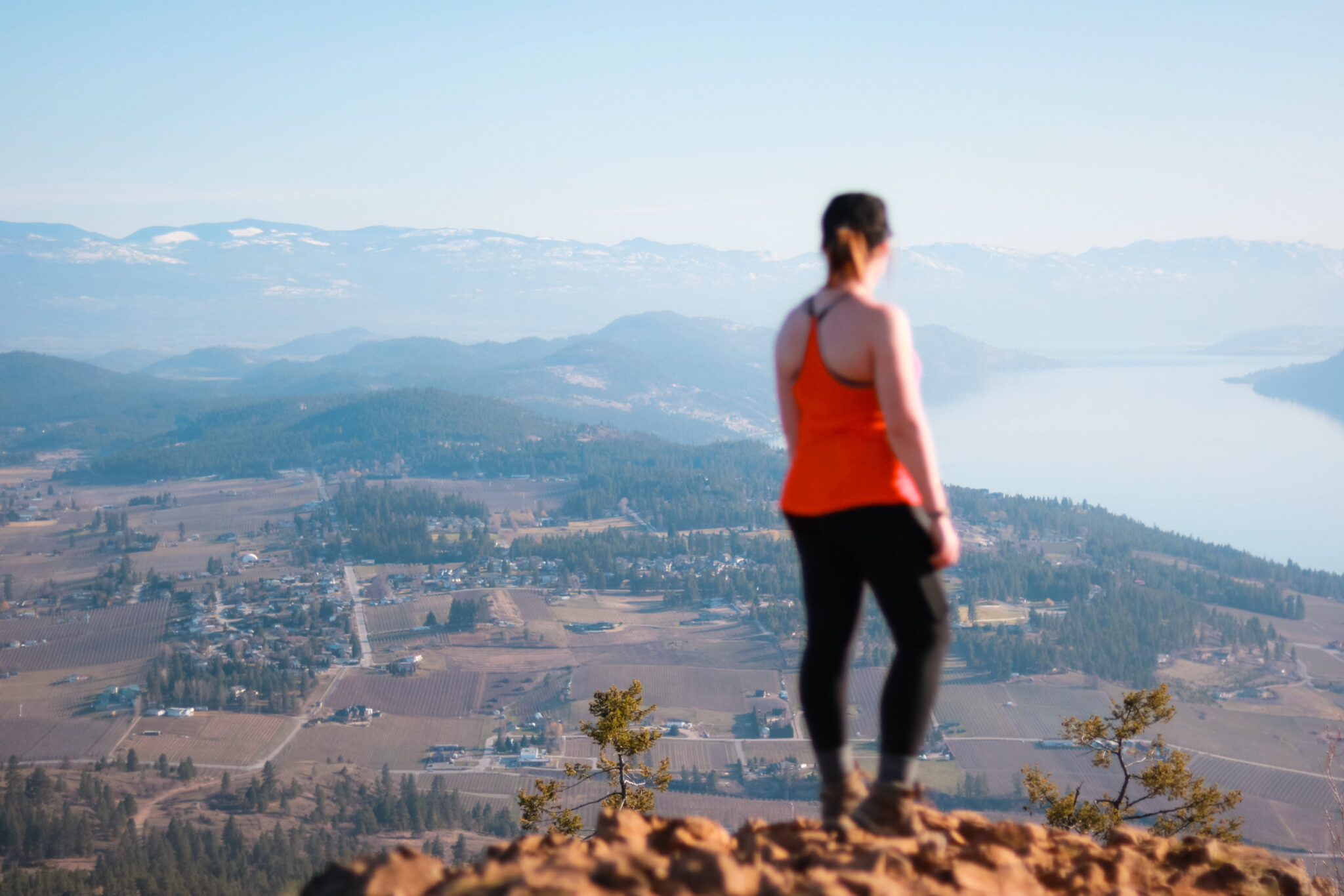
When you begin to leave the trees behind, you’ll head downhill via a few switchbacks. The trail beelines across the exposed hillside for the Cosens Bay beach. Views of Kal Lake and Cosens Bay are spectacular!
Once you reach the beach, hike to the opposite end and take the last trail at the south end of the beach. This is the Cosens Bay Express trail, which the waterfall is located on.
Hike uphill for 600 m until you reach the turn-off for Cosens Falls (info below).
Cosens Bay Parking Lot Route (6.7 km)
From the Cosens Bay Parking Lot, hike towards the dirt road at the end of the parking lot. Near the info board, you’ll see a trail called Cosens Bay Trail head off in the same direction as the road. Take this route.
You’ll hike along the bottom of a mountain, just outside the tree line in a grassy field. As you top the hill, the view of Kal Lake is beautiful!
The trail crosses the dirt road and heads downhill through some trees. Eventually, you’ll meet back up with the dirt road.
Hike along the dirt road for ~500 m until you reach the top of the Cosens Bay Express Trail. The trailhead is right off the road and marked by a sign. Follow the trail downhill for approximately 430 m until the turn-off for Cosens Falls (info below).
Cosens Bay Express Trail
Regardless of which route you take, you’ll end up hiking on the Cosens Bay Express Trail. This trail is a narrow, single lane trail that hugs the forested mountainside. It’s a multi-use trail, so it’s common to encounter mountain bikers.
The Express Trail connects the road with the Cosens Bay beach. It follows power lines (but they’re not too noticeable) and has gradual elevation change. The views of Kal Lake from here are beautiful.
The trail is exposed with little to no tree cover, but there are nearby trees.
Waterfall Turn-Off
The turn-off for the Cosens Bay waterfall is about halfway through the Cosens Bay Express trail (regardless of which direction you take).
There’s no obvious sign or trail marker showing you where to head off-trail to find the waterfall. In fact, you’ll probably feel like you’re in the wrong place because it really doesn’t look or sound like there’s a waterfall nearby.
It’s best to use a GPS the first time you’re trying to find the waterfall; the coordinates are 50.19376, -119.25416.
Watch out for a very faint trail that branches off the Cosens Bay Express trail and heads uphill into a clump of trees. The dirt trail is steep and short. As you head into the trees and towards the waterfall, the trail becomes more pronounced.
Use Caution
This is a very short trail, only ~230 m one-way from the Express, but it’s steep and narrow. The closer to the waterfall you get, the worse and more precarious the footing becomes; in a few places you may have to use your hands for balance.
This part of the trail should only be attempted if you’re steady on your feet.
I’m not trying to make it sound extremely difficult or anything, but the last bit is more than a simple saunter through the woods. Having said that, most people probably won’t have any problems.
Cosens Bay Waterfall Viewpoint
Cosens Bay Falls is a small waterfall tucked into a shaded crevice surrounded by a steep hillside and rocky cliff. Snow and ice hang around longer in the spring than elsewhere in the Okanagan. It’s a pretty waterfall, but is somewhat difficult to access.
There’s one small viewpoint for Cosens Falls which gets right up close to the waterfall, but doesn’t provide an expansive view.
This “viewpoint” is nothing more than a steep, dirt hillside. There’s a small fallen tree that you can use as a seat or hand hold to get a closer view of the waterfall.
Depending on your ability and confidence around steep, slick dirt hills (mine’s almost zero), you can either walk right up to the waterfall or go downhill to see it from below. Be careful while doing this.
Seasonal Changes
Throughout the year, Cosens Bay Waterfall changes a lot!
In the winter, the waterfall completely freezes and is quite impressive; you can walk in and behind the waterfall! Bring spikes so you can head downhill and see an even more impressive view of the waterfall.
In the spring, the water is freely flowing from the melting snow and shoots off the rocks above, landing a few feet below the main viewpoint. There’s often still some snow in mid-April. While not as impressive as the frozen waterfall, it’s still very pretty!
Come summer, though, the water dries up and there’s barely a trickle left.
FAQ
The spring and winter are the best time to visit Cosens Falls. In the spring, the snow melt creates a free-flowing waterfall; in the winter, it’s a beautiful frozen waterfall. It’s not recommended to visit Cosens Falls in the summer because the waterfall is dried up.
Yes, you can bring your dogs hiking on-leash at Kal Lake Provincial Park. There’s also a pet beach on the eastern end of the Cosens Bay beach. However, rattlesnakes do live in the area which can be dangerous to your pets.
